For the first time in 25 years, California has a snowpack trifecta
Published in News & Features
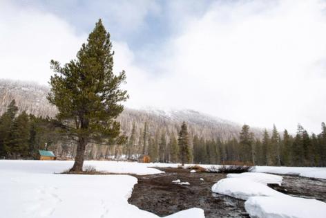
LOS ANGELES — The year may have started with a dry spell, but the end of California’s storm season has brought more fresh snow to the Sierra Nevada, pushing the state’s snowpack to 96% of average on April 1, when the snow season typically reaches its peak.
The near-average snowpack has given the state a third straight year of ample water supplies in the mountains — something that hasn’t happened in a quarter of a century.
“Earlier on, there were some indicators that we might have a dry year, but fortunately, the storm windows have stayed open and given us a good boost in February and March to be where we are today,” said Andy Reising, manager of snow surveys and water supply forecasting for the California Department of Water Resources.
This near-average winter followed an extremely wet and snowy 2023 and a wet 2024. This time last year, the snowpack measured 111% of average.
The dominance of wet weather has brought a reprieve from the severe drought Californians endured from 2020 through 2022, the state’s driest three-year period on record.
The last time California had three consecutive years of average or above-average snow was from 1998 to 2000, Reising said. At that point, it had been 20 years since a similar pattern occurred, from 1978 to 1980.
This year’s storms have brought ample rains at lower elevations, and statewide precipitation since Oct. 1 measures 103% of average for this time of year.
The last two wet years have also left California’s reservoirs in good shape. The state’s major reservoirs are now at 117% of average levels.
The Metropolitan Water District of Southern California, which delivers water for 19 million people in six counties, has a record amount of water banked in reservoirs and underground storage areas.
“The reservoirs are above average for this time of year, and so that’s a great sign for this year moving forward,” Reising told reporters during a briefing Tuesday.
California’s snowpack typically provides nearly a third of the state’s water supply.
The latest storms and increased snowpack prompted state water officials last week to increase their forecast of water deliveries this year from the aqueducts of the State Water Project, which transports supplies from the Sacramento-San Joaquin River Delta to Southern California. The allocation was increased to 40% of requested supplies, up from 35% a month earlier.
The Trump administration also announced last week that it increased water allocations this year for the Central Valley Project, or CVP, the federally managed system of dams and reservoirs that delivers supplies from the Delta to farmlands and communities in the San Joaquin Valley.
Many agencies that receive water from the CVP were already set to receive 100% of their allotments, and the U.S. Bureau of Reclamation announced that agricultural irrigation districts south of the Delta will now receive 40% allocations, up from an initial 35%, while those that receive water from the Friant-Kern and Madera canals will get 100% of their allotments.
The federal agency said in a written statement that it was seeking to “maximize” water deliveries as President Donald Trump recently directed in an executive order. Large agricultural water districts in the Central Valley have supported Trump’s order, while environmental advocates have raised concerns that federal efforts to increase pumping in the Delta could threaten vulnerable fish species that have already suffered declines in recent years.
The Bureau of Reclamation said that, acting under Trump’s executive order, it would “continue to maximize pumping whenever possible at the federal pumping facility to move water to parts of California where it is needed most.”
Although the ample snowpack and nearly full reservoirs mean stable water supplies for California for the time being, officials and experts caution that the next dry spell could come at any time.
Scientific research has shown that droughts are growing more intense in the western United States because of global warming and that average snow lines have been creeping higher in the mountains as temperatures rise, altering runoff patterns.
In February, scientists noted that the snowpack was significantly smaller at many lower-elevation monitoring sites in the mountains after months of warmer-than-average temperatures.
This year also brought a pattern of more snow and wetter conditions in Northern California, with less snow and drier conditions in Southern California. As of Tuesday, the snowpack measured 118% of average in the northern Sierra Nevada, 91% of average in the central Sierra and 84% of average in the southern Sierra.
Daniel Swain, a climate scientist at UCLA, said in a social media post that after Tuesday’s cold weather system departs, “spring will begin in earnest across California,” with much drier and warmer conditions in the coming days.
©2025 Los Angeles Times. Visit at latimes.com. Distributed by Tribune Content Agency, LLC.


Comments